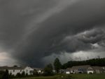
(RNN) – Hurricane Isaac has been downgraded to a tropical storm but remains a threat to life and property along the Gulf Coast, according to the National Hurricane Center.
Hazards from storm surge and inland flooding are still taking place, as the storm’s maximum sustained winds are near 70 mph.
In a news conference Wednesday, Louisiana Gov. Bobby Jindal said the Plaquemines Parish levee may be intentionally breached to relieve some of the pressure caused by flooding from Hurricane Isaac.
He said there was no estimate on when they may breach.
The slow-moving storm caused water to start pouring over the top of the parish levee before daybreak. Jindal also said there was an unconfirmed report of a fatality in a fire in Gretna, LA.
There have been around 150 calls for rescue Wednesday from rising flood waters in Plaquemines Parish, according to CNN. A total of 75 people have been rescued in Braithwaite, while at least 25 more wait on rooftops and in attics.
The parish is part of the New Orleans statistical area and shares a border with Orleans Parish. The overtopped levee stretches for about 18 miles, from Braithwaite to White Ditch.
New Orleans Mayor Mitch Landrieu issued a dusk-to-dawn curfew for the city.
CNN reported more than 8,000 National Guard personnel were at the ready for relief operations, and at least 4,100 people were in shelters. CNN reported more than 673,000 total had lost power across five states.
Additional mandatory evacuations have been ordered. The National Weather Service predicts dangerous storm surges and flood threats in southeastern Louisiana to last through Wednesday night.
The overtopped levee was left out of the federal rebuilding of the levee system, although the parish was in the process of fortifying it before Isaac hit.
A statement from emergency management officials said this will result in significant flooding in that area.
About 310,000 customers were without power in Louisiana by daybreak. The majority of outages are in the southeastern region of the state, including New Orleans.
In its 2 p.m. advisory, the National Hurricane Center tracked Isaac creeping northwest at 6 mph, and located 50 miles west-southwest of New Orleans, and 55 miles south-southeast of Baton Rouge, LA. It is expected to continue moving in the same direction through the night.
The hurricane had been hesitant to move ashore but made its second landfall at 2:15 a.m. CT in the southeastern port of Port Fourchon, LA.
The NHC is predicting rainfall totals between 7 to 14 inches for much of Louisiana, southern Mississippi, southern Alabama and the extreme western Florida panhandle. However, totals could reach a maximum of 20 inches in harder hit areas.
The NHC forecasted hurricane wind conditions are expected to spread across southeastern Louisiana into Wednesday morning. The high winds may also cause isolated tornadoes along the central Gulf Coast and lower Mississippi River Valley into Wednesday.
Many of those outages may not be fixed until the storm has completely passed, which may take awhile given Isaac’s slow movement.
Isaac’s plodding path is a major flooding concern for communities across the Gulf region.
The NHC predicted water levels could reach 6 to 12 feet above ground in Mississippi and southeastern Louisiana; 3 to 6 feet in Alabama south-central Louisiana; 2 to 4 feet in the Florida panhandle and Apalachee Bay; and up to 3 feet on in the remainder of the Florida west coast.
Storm surges of 11 feet have been recorded in southeastern Louisiana.
In New Orleans, all levees, pumping stations and flood gates are holding as expected. No major flooding has occurred in the areas within the levee systems. The flood-prevention system received an $11 billion upgrade after Hurricane Katrina tore through it in 2005.
CNN reported a barge broke loose in the city due to winds reaching over 60 mph. The barge continued to hit three unoccupied passenger ships in the area. A 47-foot boat sunk in the accident.
Mississippi has also experienced tropical storm-force winds and torrential downpours. Mandatory evacuations were ordered in the low-lying areas of Harrison County, MS.
The hurricane warning and watch have been discontinued.
A tropical storm warning remains for the area from east of the Mississippi-Alabama border to the Alabama-Florida border, as well as from Morgan City to Sabine Pass, TX. A tropical storm watch for east of High Island, TX, to west of Sabine Pass.
The tropical storm warning for east of the Alabama-Florida border was discontinued.
http://www.19actionnews.com/story/19403429/isaac-pours-over-gulf-coast-prompts-flooding
Article Courtesy of WOIO 19 Action News
Want to Keep Up With WZAK? LIKE Us On Facebook!
Recent Updates
- Tom Joyner News: Chad Johnson could face one-year sentence!
- Tom Joyner News: Ken Smukler’s Trickery Report!
- 10 Things Every Woman Going Through a Divorce Wants to Hear
- The Rules of Swinging
- 10 Things Women Do that Really Put Their Guys to the Test
WEATHER: Issac Now A Tropical Storm, But Still A Threat was originally published on wzakcleveland.com


