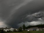
The center of the super storm will move over Southern New Jersey this evening. The forecast track will take it east of us tomorrow. Deep moisture will continue to filter and that means more rain. Additional rain of over 1″ can be expected through tomorrow for most of the area. This will create flooding concerns. The strongest wind will be tonight and tomorrow especially along the lake.
TONIGHT: Rain with damaging wind especially along the lake shore. 7 A.M. Temperatures will be in the he Low-Mid 40s. Wind: North at 29-58 mph with gusts over 60 mph along the lake shore.
TUESDAY: More rain and damaging wind especially along the lake shore. High: Mid-Upper 40s. Wind: North at 22-42 mph with higher gusts.
WEDNESDAY: More rain and windy conditions. High: Low-Mid 40s.
The center of the super storm will move over Southern New Jersey this evening. The forecast track will take it east of us tomorrow. Deep moisture will continue to filter and that means more rain. Additional rain of over 1″ can be expected through tomorrow for most of the area. This will create flooding concerns. The strongest wind will be tonight and tomorrow especially along the lake.
Click here for the Weather Watches and Warnings: http://www.19actionnews.com/story/16198656/forecast
Article Courtesy of WOIO 19 Action News
LOCAL: The Super Storm Has Arrived in Cleveland and Northeast Ohio was originally published on wzakcleveland.com